

Let’s talk again about hiking on Mount Subasio Park, nature, history and peasant life. In fact, until the mid-twentieth century, the existing hiking trails were ways of communication and services for the inhabitants of the “mountain”, accustomed to living daily in a mixture of hate and love with the rugged nature that surrounded them.
Over the centuries, the Trail 53(renumbered 353) and 55(355), the two routes of the CAI (Italian Alpine Club) taken into consideration in this article, have been covered countless times by hardworking farmers and herders to move between villages and/or to reach the summit places.

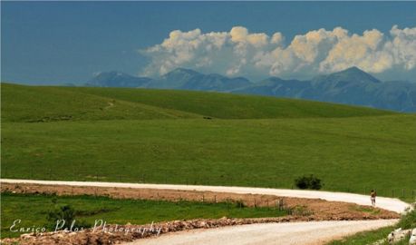
The route marked with 55(355) leads, following the maximum slope line, from the village of Armenzano the top of Mount. Like the Footpath 52(352) (Collepino – Mount Subasio), 58(358) (S. Giovanni – Madonna della Spella) and 61(361) (Costa di Trex – Mount Subasio), it was, and it still is, used to transfer the flocks on the pastures higher than 1000 meters altitude.
The fact that the latin name of Armenzano is “herd”, makes it clear how the breeding was fundamental for the economy of this and other villages of half-coast of the Regional Park and you can imagine the usefulness and importance of those old sheep tracks for the pastures of flocks.

Keeping in theme, embarked on the Footpath, the first locality you meet is called Trocchi of Armenzano, taking its name from the ancient basins (trocchi) to water their flocks, fed by a nearby spring. Continue for a closed to motor-traffic route, it passes near the water supply tank of the town, and then turn right and start a broad and steep sheep track in the woods. Going up, the landscape behind you begins to open up more and more on the part of the Apennines between Mount Pennino and Mount Catria.
You exit the woods, reaching the summit meadows (altitude 1160 m). Climbing further you meets the Mortaro of Troscie, a circular sinkhole (depth 50 mt – 160 mt diameter). We cross on the right the route 61(361) from Costa di Trex, the two footpaths are joined, coming together at the top.

The trail ends at the Shelter of the Mortaro (1,284 mt a.s.l.); keep right you can go up to the highest point of the Subasio (altitude 1,290 mt), while, turning left you can reach the nearby sinkholes of Mortaro Grande e Mortaro Piccolo.
If the Route 55(355) crosses the Mount from the bottom up, the Path 53(353) crosses the Subasio, between meadows and woods, from its eastern side, touching from above the locality: Stazzi, Costa di Trex, Armenzano and San Giovanni Collepino. This Footpath is also known as Route of the Ditches, because it crosses the 10 main ditches that line the eastern side of the Subasio.
The Footpath has a mobility guaranteed stretch, it pass through the paths 61(361) and 55(355), it exceeds a rest area for picnics and it leads to the Banditelle Refuge of Armenzano. The shelter is powered by renewable energy, there is a meteorological survey station, some lavender plants and an experimental truffle plants.
It continues to the village of San Giovanni di Collepino. A memory of a franciscan past still alive and the last place to see, it is the Ditch of Vettoio, where St. Francis loved to take refuge, in meditation and contemplation of nature, and where, even today, there is the ancient natural cave where the saint took shelter.


